TraCSS Schedule & Roadmap
This page hosts the latest publicly released schedule and roadmap for the Office of Space Commerce’s Traffic Coordination System for Space (TraCSS).
As updates to the schedule and roadmap are made, this page will be refreshed to reflect them.
Documents:
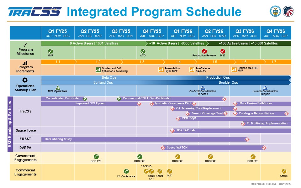
- TraCSS Integrated Program Schedule (.PDF, July 2025)
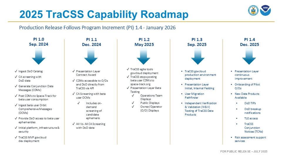
- 2025 TraCSS Capability Roadmap (.PDF, July 2025)
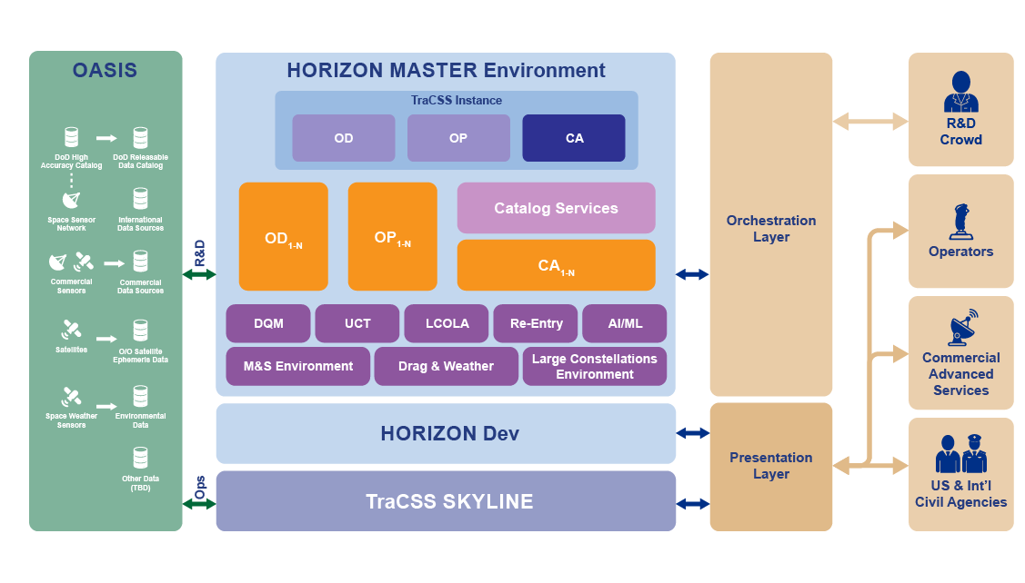
- TraCSS Post-Production Release Architecture (.PDF, July 2025)